Ryan Environmental
East Coast Trail Association
Encyclopedia of Newfoundland
and Labrador
Irish Loop Home Page
Memorial University Biology Department
Visitor number
FastCounter
by bCentral
I was hired by the East Coast Trail Association for the period of August 21 to Dec. 22, 2000 as a writer-researcher and a "gofer". Subsequently, I was rehired from May 10 to June 14, 2001 and again from August 3 to October 12, 2001. As a writer-researcher, my job was to hike the East Coast Trail, observe it, write stories about its natural history, and to research community heritage. As a "gofer" my job was to record distances along the Trail with a measuring wheel, obtain a photographic record of the Trail, create backup systems for the Association computers, and to provide any other services required.
Originally, I applied for a job as part of the Trail building and construction crew because my wife Loretta said it was a job I could do. During the job interview, Ed Delaney, the East Coast Trail Association Operations Manager, asked if I could identify flowers. I said yes and told him that I had books on the subject, was a licenced guide, and that I had been President of the Canadian Society of Environmental Biologists for 5 years. After a couple of more chats with Association staff, I got a job. It was the first full time job I had since I retired from the Department of Fisheries and Oceans in 1998.
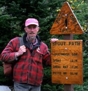
Subsequently, I helped Peter Gard and Libby Creelman identify plants and other creatures in preparation for the creation of the East Coast Trail Guide. Peter is a founder of the East Coast Trail Association and is credited with starting the whole thing. He is an accomplished guidebook writer. Libby Creelman is a biologist and published author. Libby and Peter took the pictures of me with the Trail sign and the moose, respectively. We hiked the Trail together and wrote stories about it back in the office. These Two Dozen and Ten Tales of the East Coast Trail are the ones I wrote. Nine of these tales are appended to the two dozen and one published in 2000.
Loretta Ryan and East Coast Trail Association Staff constructively reviewed earlier versions of the manuscript.
Pat Ryan
Riverhead Road, P. O. Box 58,
Mobile, Newfoundland, Canada
A0A 3A0
Tel. (709) 334-2962 email patrickr@mun.ca
Ryan Environmental at:
http://www3.nf.sympatico.ca/patrickm.ryan/
BACK TO TABLE OF CONTENTS
The East Coast Trail currently is a hiking trail of approximately 220 km from Fort Amherst in St. John's to Cappahayden on the Southern Shore of Newfoundland, Canada. The Trail is divided into sections called Paths, each with its own distinctive characteristics and hiking challenges.
The East Coast Trail has been developed by more than 700 volunteers and up to 60 paid workers under the direction of the East Coast Trail Association. Founded in 1994, the Association was formed to develop a world-class hiking trail along the east coast of the Avalon Peninsula. The Association is an incorporated, non-profit, registered charity. Its mission is :
- To develop and maintain the East Coast Trail
- To advance the conservation and protection of the Trail
- To promote the Trail locally, nationally and internationally
- To encourage the growth and development of local businesses
- To promote recreation hiking
- To document and preserve the natural and cultural features of the
Trail.
The website of the East Coast Trail Association is located at:
http://www.eastcoasttrail.com/
The Association has its head office in St. John's at:
East Coast Trail Association
50 Pippy Place
P.O. Box 8034
St. John's, Newfoundland
A1B 3M7
Phone: (709) 738-HIKE (4453)
Future developments planned for the East Coast Trail include continuous
Trail upgrades and maintenance as well as expansions from Cappahayden to
Trepassey, across the Avalon Peninsula to Placentia, and around Cape St.
Francis to Manuels.
BACK TO TABLE OF CONTENTS
The East Coast Trail has a cool maritime climate with February being the coolest month and July and August being the warmest months. However, the overall climate of the Trail, like the rest of the province, is characterized by considerable seasonality and unpredictability, often with rapid, short- lived changes that are difficult to predict.
The vegetative or growing season (when mean daily temperatures are above 60 C) ranges from about mid-May to the end of October. Average monthly temperatures in July and August range from about 12-180 C. Average daily temperatures in July and August from about 11-210 C can range up to 300 C.
Total annual precipitation averages about 120 cm and tends to be least (about 7-9 cm/month) in July and August.
The prevailing winds are westerly, with southwesterlies in summer. Surface wind speeds average 20-30 km/hour along the coast with sustained gusting to 50-80 km/hr during storm events. Rain- drizzle-fog events usually occur when easterly winds blow off the ocean. Fog is most frequent during spring and summer but can occur at any time of the year when warm, humid air from the south strikes the cold waters of the Labrador Current.
The average daily air temperature reaches 0° C near the beginning of April and the Trail remains relatively cool throughout the summer because of the nearby sea surface temperatures of 10-13°C. The Labrador Current, flowing from the Arctic, travels along the east coast and a branch swings westwards round the island along the south coast. These cold waters carry surface ice and spectacular icebergs during the spring and early summer months, cooling the Trail.
From late fall until early spring, frequent temperature fluctuations about the freezing point occur. These freeze-thaw cycles result in an accumulation of ice on exposed surfaces and hazardous driving and walking conditions. Such icing is known locally as "glitter", "glaze" or "silver thaw". Typically, individual icing events are short-lived (3-8 hours) but prolonged periods resulting in a glaze of more than 5 cm do occur..
The first snowfall to cover the ground usually occurs in the latter half of November. Blizzards may occur on the Trail from then until early spring. Heavy snow with strong winds has resulted in snow avalanches such as occurred at the Battery in St. John's on February 16, 1959, following a record 24-hour snowfall of 81 cm. Recently however, relatively mild winters have resulted in snow depths well below normal and more frequent wet weather.
Extremes in climate can be expected on the East Coast Trail as evidenced by comparisons of St. John's weather with that of other Canadian cities. Of the major Canadian cities, St. John's is the foggiest, snowiest, wettest, windiest , and cloudiest. It also has more days with freezing rain and wet weather than any other city but it has the third mildest winter.
Lakes, pools, ponds, puddles, streams, and rivers on the East Coast Trail are homes to a host of aquatic invertebrates (animals without backbones). Most drainage systems have a variety of flow regimes from fast to slow moving to stagnant waters with invertebrate communities characteristic of each regime.
Stream outlets from lakes or ponds tend to have the highest concentration of invertebrates and thus provide convenient observation locations. These outlet streams are densely populated by immature forms of filter-feeding caddisflies (Trichoptera) and blackflies (Simuliidae) and are overflown by insect eating adult dragonflies and damselflies (Odonata), and the reproductive stage of spring and fall mayfly (Ephemeroptera) communities.
More than 100 species of caddisflies have been discovered in the province. Caddisflies occupy a broad range of aquatic habitats including the deeper waters of ponds and lakes. Caddisflies generally have very diverse life cycles, but generally have one generation each year as immature forms (aquatic larvae and pupae) and free-flying adults. Their success has been attributed to their ability to spin silk. Their silk is used to net drifting food particles (filter feeding) or build protective camouflaged portable or fixed shelters out of sticks, leaves, and/or stones (case making). Some caddisflies may be easily seen in their 0.5-2 cm tube cases on or under rocks that have been partially scraped of algal filaments.
Many life history patterns are present among the 22 species of Newfoundland blackflies and they may produce one to several generations each year. Eggs are deposited near the surface of the water and the young, as larvae, develop in the water as white to grey to brown-black wormlike (about 3-4 mm) wigglers attached to, or crawling about, the bottom. Enormous populations of the larval forms can be found clinging to the rocks (and making them slippery for hikers) as they filter feed at pond outlets prior to their emergence as biting adults.
Dragonflies and damselflies (Odonata) are large (5-7 cm), conspicuous fliers on the East Coast Trail from mid-June to mid-October. They can be seen near all water bodies, especially on warm, sunny days with light winds. Adults deposit their eggs near the water surface. The grey to green immature forms (nymphs) with the beginnings of wings typically develop in association with rooted vegetation or accumulated plant debris as they hunt other insects. Life spans can be greater than 3 years. Adults of both dragonflies and damselflies hunt other flying insects and have two pair of net-veined wings. Dragonflies are larger than damselflies and are much stronger fliers. Thirty-five species of Odonata are known from the island.
Newfoundland mayflies (Ephemeroptera) make up about 30 species whose
nymphal forms may be found in both flowing or still waters. Typically,
the short-lived, non-feeding, exclusively reproductive adults deposit the
eggs near the water surface in the spring or summer. Eggs hatch in late
summer or fall. The following year, the nymphs depart the aquatic environment
and change into a sub-adult for about 24 hours and then into fully formed
"spinners". Adults have multi-veined, transparent wings held vertically
together when at rest and, at the tail, have two or three long delicate
filaments. On calm days or evenings, males form hovering swarms with individuals
spinning down through the swarms. Females enter the swarms individually,
emerge with a male, and mate during flight. On the East Coast Trail, mayflies
can be seen swarming in both spring and fall in a temporal separation of
ecologically similar species.
BACK TO TABLE OF CONTENTS
On the eroded headlands of the East Coast Trail, high scour heights and the absence of cliff vegetation provide an indication of the potential for stormy weather. Prevailing westerly winds can veer, gust and gale, particularly in winter when the Icelandic low pressure systems affect the island and cyclonic disturbances, tropical and continental, come from the south and southeast. In August and September, tropical storms may approach southern Newfoundland and bring intense periods of rain and storm force winds (sustained velocity above 70 km/hr, with gusts well over 100 km/hr).
Marine transportation systems are often stopped by severe winds and resulting sea state conditions, which are most likely from November though March. Strong winds can uproot or crack off trees as happened in St. John's on October 6-7, 1992. Saturated soils and heavy foliage contributed to that damage. On January 25, 1966, a severe storm and associated tide demolished most of the community of La Manche.
Heavy snow with strong winds causes low visibility blizzards and snow avalanches such as occurred at the Battery in St. John's on February 16, 1959, after a record 24-hour snowfall of 81 cm. Blizzards may occur on any part of the Trail from late fall through early spring, with greater likelihood on the exposed higher ground.
Ice storms (known locally as "glitter", "glaze", or "silver thaw") occur most frequently over the eastern coastal sections of the island. In most years, the individual occurrences are of short duration (3-8 hours), but serious problems do occur. In March, 1958, a 43-hour storm disrupted the power over the northeast Avalon Peninsula. From April 11-14, 1984, icing up to 22 cm thick on one-inch diameter wires over the northeast Avalon resulted in a loss of electricity for 4 days and a $10 million cost to the system.
Heavy rainfall occurring over a few hours to a period of consecutive days under some weather patterns can saturate the ground, overflow streams and rivers, flood basements, wash out roads and bridges, and break water supply lines. On September 15, 1996, 70-80 mm rain from tropical storm Hortense poured over the northeast Avalon Peninsula in a few hours.
Thirty year weather compilations by Environment Canada indicate that
the East Coast Trail holds two Newfoundland records. These include the
maximum rainfall in a 24-hour period (15.72 cm at Cape Race) and the maximum
wind gust (193 km/h at St. John's). Also according to Environment Canada,
of all the major Canadian cities, St. John's is the foggiest (124 days,
next to Halifax's 122), snowiest (359 cm, next to Quebec City's 343), wettest
(1514 mm, next to Halifax's 1491), windiest (24.3 km/h average speed, next
to Regina's 20.7), and cloudiest (1497 hours of sunshine, next to Charlottetown's
1818 hours). It also has more days with freezing rain and wet weather than
any other city, but it has the third mildest winter in Canada (next to
Victoria and Vancouver).
BACK TO TABLE OF CONTENTS
Hikers on the East Coast Trail will most likely encounter biting insects from spring to fall. Biting insects living on the Trail include varieties of blackflies, biting midges, mosquitoes, horseflies and deerflies, pollen bees, wasps, and ants. Biting flies tend to be most active at sunset and sunrise, when winds are low, temperatures are warm and humidity is high.
Blackflies (Simuliidae)
Blackflies are small (2-5 mm), stout, black-bodied flies with a humpbacked
appearance. The adult females use their short, cutting mouth parts to slice
the skin and feed from the resulting pools of blood. Most require a protein
(blood) meal for egg development but some do not. Blackflies are members
of the insect order Diptera and undergo a complete development from egg,
larva, and pupa to adult forms. Blackfly eggs usually are deposited on
logs, rocks, or solid surfaces in swiftly flowing streams and the hatchlings
(larvae) use their posterior sucker to attach themselves to rocks or vegetation.
Larvae prefer shallow water with a rapid rate of flow. The length of the
larval period is variable depending on the species (some 22 in the province)
and the environment (particularly temperature), but there may be several
generations each year and some larvae are present all year around. After
pupation, the adults emerge and may fly 7 to 10 miles from their breeding
sites.
Biting midges (Ceratopogonidae)
Biting midges are small (adults usually less than 2 mm) members of
the insect Order Diptera. The biting females are painful and typically
require a blood meal to mature their eggs. Adults are dark gray to black,
have one pair of spotted wings, and are often referred to as "punkies,"
"no-see'ums" or sand flies. The different species (about 30 in Newfoundland)
breed in a variety of environments from salt marshes to fresh water ponds
to tree holes. Most species seldom bite when there is air movement but
people having a high body temperature, such as outdoor workers, attract
female midges.
Mosquitoes (Culicidae)
Mosquitoes are long-legged, 4-10 mm long, delicate-winged insects with
a long, sharp mouthpiece used to puncture skin and suck blood. They are
most active at dusk or at night in swampy and woody areas. Like other members
of the insect order Diptera, they undergo a complete development from egg,
larva, and pupa to adult forms. However, there are life history variations
among the 20 species known from the island. Eggs may hatch into the larval
stage in 2-3 days or overwinter. Larvae can be seen wiggling at the surface
of the water until pupation days to months later. Emerging adults mate
and, in most species, the female seeks out a blood meal for egg development.
Up to 100 eggs are laid in stagnant water or close to it. Mosquitos are
attracted to dark clothing, exhaled breath, perfumes, and body odor.
Horseflies and deerflies (Tabanidae)
Horseflies and deerflies are fast-flying, thick-bodied, broad-headed
flies whose bulging eyes are often brightly colored and whose wings are
dark brown, smoky, or black. Known locally as "stouts", they range in size
from about 10-28 mm and can inflict very painful bites. Fifteen species
are known from the island and they are very common in woody or marshy areas.
The female bites and sucks blood with the assistance of an anti-coagulant
in her saliva. Some small animals die when attacked by large numbers of
stouts. Males do not bite but feed on the nectar and pollen of flowers.
The females lay their eggs in clusters on leaves or plants overhanging
the water and later die in the fall. The emerging deerfly larvae drop into
the water where they prey on small animals until pupation and usual emergence
from May to August.
Pollen bees (Apoidea)
Native bees, wild bees, or pollen bees are all those bees other than
honeybees. They are of varied sizes and colors, from big (about 20 mm),
black and yellow-orange, buzzing bumble bees to a variety of smaller bees.
Most kinds of pollen bees live mostly solitary lives. Females mate, and
then each makes her own simple nest, provisions it with nectar and pollen,
lays the eggs, seals the nest, and departs to start again. Some pollen
bees, such as bumble bees, are social insects. The mother bee builds a
nest, usually in a hole in the ground, and becomes a queen bee with worker
daughters. Different pollen bees are active adults at different times of
the year coinciding with the blooming of their preferred host plants. Pollen
bees usually will not bother people unless they are threatened and male
bees never have a sting.. Try not to swat at approaching bees and avoid
wearing bright colored clothing with flower patterns and heavily scented
perfumes.
Wasps (Vespidae)
Wasps are about 15 mm long with black and yellowish coloration. The
wings of most are folded
longitudinally when at rest. They are more dangerous and unpredictable
than bees and should be treated with caution. Wasps construct nests of
a paper-like material which is a mixture of their saliva and chewed wood
or leaves. They are social insects with queens, female workers, and males
which don't sting. Common paper wasps typically build their umbrella-shaped
nests under eaves and ledges. Hornets build large, inverted, tear-drop
shaped balls on trees, bushes, and the sides of buildings. Hornet nests
may contain large numbers of wasps which will become extremely aggressive
when disturbed. Yellowjackets are another dangerous wasp with nests often
located underground in old rodent burrows, beneath timbers, or in walls.
Like bees, wasps usually will avoid contact with people unless threatened
and, if they approach, a slow, quiet retreat may be the best course of
action for hikers.
Ants (Formicidae)
Ants are social insects living in almost every type of habitat. There
are many different species and their nests may be constructed in the ground
(as anthills), in rotten logs, or in plant cavities. Some ants have a stinger
for attack and defense and all may bite. Problems from ants can be avoided
simply by staying off ant hills on the Trail.
BACK TO TABLE OF CONTENTS
The East Coast Trail is home to three of Newfoundland's smallest mammals- the meadow vole or field mouse, the house mouse, and the masked shrew. They are important food sources for a variety of other wildlife on the Trail, including foxes, weasels, mink, lynx, coyotes, trout, salmon, hawks, owls, crows, herons, and other birds of prey.
Meadow Vole (Microtus pennsylvanicus)
Meadow voles, commonly called field mice, are widely distributed throughout North America, including the East Coast Trail. The total length of the meadow vole is about 128 to 195 mm with a tail about 40% of the body length. It has a fat, fuzzy appearance and short ears. Its back is brown which may be shaded with red, grey, or black. Its lighter underside, which may be tinged with light brown, is silvery to buff-colored to dark grey. Its duller winter coat is more greyish.
Meadow voles inhabit meadows, fields, grassy marshes, hillsides, rocky areas, forest floors, and the edges of rivers, lakes, and bogs. They swim well and are active day and night all year around. The meadow vole nests and makes extensive pathways above and below ground. The 25-50 mm wide pathways made through vegetation underneath the snow are often revealed by round openings to the surface of the snow and are easily visible near the edges of the snow as it melts. Voles feed on a variety of fresh vegetation including grasses, sedges, fruits, grains, seeds and, during the winter, may feed on the bark and roots of shrubs and small trees. Voles feed extensively on the abundant cranberries of the East Coast Trail.
Meadow voles breed all year around, with the most common litter size being six or seven. They may live up to three years but, in the wild, usually live less than a year.
Voles are vocal. Quietly resting hikers may hear them squeaking at one another.
House Mouse (Mus musculus)
Ancestors of East Coast Trail house mice migrated to the island with
early European shippers.
The total length of the house mouse is about 150 to 180 mm with a tail
about 50% of the total length. Adults are tan, brownish, or brownish grey
above with large ears, a greyish belly and a scaly, nearly hairless tail
with the same color above and below.
House mice prefer areas with stored or leftover grains, fruit, and garbage. They often inhabit fields and forested areas in summer but, if possible will move inside human buildings for the fall and winter. They are active all year around, mostly at night, and cannot see much beyond six cm in daylight. House mice will eat any food available, including insects and seeds.
House mice in human dwellings breed all year around, producing about 3-11 young per litter. In the wild, house mice usually do not breed during the winter. House mice in the wild rarely live more than a year or two.
Masked Shrew (Sorex cinereus)
The masked shrew is the smallest mammal on the East Coast Trail. Native to Labrador, 22 shrews were brought to the island in 1958 to eat a forest pest, the larch sawfly. The masked shrew has a long snout and a length of 7-11 cm, including its 3-5 cm tail. It is brownish or grayish above, with lighter underparts. The tail has a black tuft at the end. Masked shrews are active day and night throughout the year. They may be seen, in a variety of damp habitats including open areas, woodlands, forests, marshes, grassy bogs, and around streams and ponds. They will burrow through snow and winter hikers sometimes see them scurrying across the top of the snow.
Because of a very high metabolic rate (heartbeat up to 1200 per minute), shrews do not sleep long, but nap and eat constantly, consuming up to three times their weight each day. If they are without food for a few hours, they can starve to death. Shrews eat a variety of invertebrates including beetles, flies, ants, crickets, slugs, snails, worms, spiders, grasshoppers, spiders, and the larvae of butterflies and moths. Shrews hunt in existing passageways or by burrowing through grass, leaves, loose soil, and other material above ground.
Masked shrews breed from April to October and females produce 4-10 young
two or three times each year. Their nests can be found in cavities of tree
stumps and fallen logs, under rocks, or in the vacant burrows of other
animals. The mother takes the young hunting for food when they have enough
fur and they usually do not live beyond their second summer.
BACK TO TABLE OF CONTENTS
Hikers on the East Coast Trail encounter a variety of Atlantic Canada's freshwater fishes as well as record-class sport fishing locations. Non-residents require a licence to angle for freshwater fish while resident anglers require a licence only to fish for sea-run Atlantic salmon.
Brook Trout (Salvelinus fontinalis)
The brook or speckled trout is locally known as the mud trout. It is the island's most widely distributed freshwater fish and the fish most preferred by anglers. On the East Coast Trail, brook trout usually range in size from about 15-25 cm. but fish in excess of 40 cm are present. Brook trout colour varies from place to place and with age and sex of the fish. The back is green to brown or nearly black. The back, the nearly square tail, and the large fin in the middle of the back are marked with lighter-coloured, wavy lines. The sides are green to brown with pale spots and small distinct red spots surrounded by bluish halos. The belly varies from white to yellow in females or deep red to orange in males. The front edges of the lower fins are black with white borders.
Brook trout of the East Coast Trail live in cool lakes, ponds, streams, and even clean roadside ditches. Fish from many populations migrate to the ocean for about two months in the spring and become silvery until they return to fresh water. Brook trout usually spawn from September to November in shallow, gravel-bottomed streams or, occasionally, on lake shorelines where running water is present. Females dig a shallow nest in the gravel and cover the eggs after they have been shed and fertilized. The young emerge from the gravel in the spring at a size of 3-4 cm.
Brook trout eat a great variety of food including insects, snails, clams, and fish. They usually mature at 2-4 years of age and seldom live longer than 5 years.
Hikers will often encounter feeding brook trout dimpling the surface of ponds. Young brook trout can be easily seen resting in quiet, shallow water along shorelines.
Atlantic Salmon (Salmo salar)
Atlantic salmon, a highly prized sport fish, is variable in colour and size, depending on its life- history and environment. It occurs in river systems of the East Coast Trail as sea-run and landlocked forms. Salmon that cannot reach the sea because of barriers to migration are known as ouananiche and the sea-run fish are referred to as salmon. The young salmon (termed parr) in freshwater is a slender fish with a dark-spotted, grey-to-brown back and a white-to-yellow underside. Along the sides are single red spots between each of 8-11 dark, vertical bars.
After hatching in the spring in stream spawning areas, young salmon disperse up and downstream with many entering lake environments, typically after their first year of life. In the spring or early summer of their fourth or fifth year, the 10-15 cm. parr of sea-run stock become silvery and migrate to the ocean as smolts. After one or more (usually one) winters at sea, the silvery adults (weighing 2-10 kg. or more) return to fresh waters to spawn in the fall in the shallow, gravelly, running waters at the uppermost areas of river systems. Females excavate a shallow nest in the gravel and cover the eggs after they have been shed and fertilized. After spawning, many adults survive and return immediately to sea or overwinter in fresh water and return to sea the following spring. Many males of sea-run stock do not migrate to sea, but mature in fresh water at a size of 10-15 cm. and subsequently spawn with much larger sea-run females. Ouananiche experience a similar life history except that they migrate from stream areas and smaller ponds to the largest freshwater lakes instead of the ocean.
Atlantic salmon in fresh waters feed mostly on insects. In the ocean, foraging as far as Greenland, they eat a wide variety of food, including squid, shrimp, and other fishes.
Angling for sea-run Atlantic salmon in Newfoundland is permitted only by fly fishing with barbless hooks. Hikers on the East Coast Trail will often encounter "Scheduled Salmon River" signs at rivers where angling times and catches are regulated by the federal government and all anglers require a fishing licence. Young salmon smolts and full-sized adults can be observed jumping and feeding during a temporary pause near the mouths of rivers during their migrations.
Brown Trout (Salmo trutta)
Brown trout, native to Europe and western Asia, were introduced to Newfoundland in 1884 and are often referred to as German browns or sea trout. On the East Coast Trail, angled brown trout have an average length of about 40 cm. and 0.5-1.0 kg. but many fish in excess of 10 kg. have been captured. In fresh water, the brown trout has a brownish back, lighter brown to silvery sides, a white belly, and overall light brown or tan appearance. Large black spots on the upper body and fins often have lighter borders. Red, orange, or yellow spots with pale borders are on the sides. Brown trout that migrate to sea become silvery and much of their spotting disappears until they return to fresh waters.
Brown trout live throughout the East Coast Trail in cool-to-warm lakes, ponds, and streams accessible from the ocean. Fish that go to sea may migrate, usually in April to June, and return to fresh water after 2-4 months or one or more winters. In late fall to early winter, female brown trout dig a nest in the gravel of shallow streams or, occasionally, on lake shorelines and cover their eggs after they have been shed and fertilized. Young emerge from the gravel in the spring.
Brown trout eat a great variety of food, mainly at dusk or later. They usually mature at 3-6 years of age and seldom live longer than 10 years.
The Canadian brown trout angling record fish (in excess of 11 kg.) was captured in Lower Pond, Witless Bay on the Michaleen's Path of the East Coast Trail. Exceptionally large brown trout are regularly captured there and hikers will frequently observe anglers on the shoreline fishing with natural baits and artificial flies and lures.
American Eel (Anguilla rostrata)
The American eel is a long (up to about 1 metre), slender, snakelike fish with a continuous fin running along its back and around and under its tail. It has a pointed snout, sharp teeth, and a thick, tough skin which secretes a slimy, protective mucous. In fresh waters, the eel has an olive-brown back, greenish-yellow sides, and grey to white underparts. Colouration may alter with changes in background. As it migrates to sea from fresh water, it develops a metallic bronze to silvery sheen.
American eels spawn in the Sargasso Sea south of Bermuda from January to April and, within a year, the resulting young are carried by ocean currents northward to the waters of Eastern North America, including the East Coast Trail. From spring to summer, young eels move throughout river systems to occupy estuaries, rivers, lakes, and ponds. After about 8-20 years, adults return to spawn and die in the Sargasso Sea.
Eels eat a variety of invertebrates, including insects, snails, and worms as well as other fishes.
Hikers may see eels among the rocks in any of the larger East Coast Trail rivers or, when fishing with worms as bait, are liable to catch them anywhere. Hikers may also encounter commercial fishing nets set across streams to catch seaward migrating adult eels.
Rainbow Smelt (Osmerus mordax)
The rainbow smelt is a slender fish averaging about 180-200 mm long. Sea-run smelt tend to have clear fins and are silvery with blue to pink iridescence on the sides. Smelt in fresh waters tend to be darker. Smelt have a characteristic odour of fresh-cut cucumbers.
Smelt occur as sea-run populations or, if access to the sea is blocked, as landlocked forms in lakes. Smelt ascend from the ocean or lake into streams to spawn soon after ice-out. Adults leave the stream shortly after and their eggs become attached to the bottom gravel. The nearly transparent young hatch in 2-3 weeks, drift downstream to the estuary or lake, and by August are about 50 mm long.
Smelt are carnivorous. They feed on a great variety of smaller creatures as well as anglers' worm- baited hooks. Hikers will most likely encounter rainbow smelt in the late winter as smelt preparing for the spawning run from the ocean are captured, in estuarine environments, through the ice by anglers.
Sticklebacks
Sticklebacks commonly known as "pricklies", are laterally compressed, small (about 50 mm), green to silvery-grey fish. During breeding season in July and August, colours intensify with reds and pinks appearing. Two species can be found in the fresh waters of the East Coast Trail. The threespine stickleback (Gasterosteus aculeatus) is insular Newfoundland's second most (after brook trout) widely distributed freshwater fish. The threespine stickleback has 3 stout, serrated spines on its back. The ninespine stickleback (Pungitius pungitius) has about 9 (8-11) short (1.0-1.5 mm), isolated spines tilting alternately left and right on its back. Both species have two spines on their underside near the belly, and a shorter one ahead of the bottom fin. All of the stickleback spines can be rigidly locked in an upright position.
In their second or third summer, male sticklebacks collect plant material and construct a barrel- shaped, open-ended nest in shallow water. Threespine sticklebacks prefer a sandy area on the bottom, while ninespine sticklebacks usually build off the bottom in the plants. After courtship displays by the male and spawning, the male guards the nest and the young until he is unable to control their movements. Adults seldom live beyond three years.
Sticklebacks eat any available animal foods. They, in turn, are prey
for a variety of fish-eating birds and other fishes, in spite of their
spines. Sticklebacks can be readily seen foraging near the shorelines of
ponds and, with the aid of polarized sunglasses, hikers may observe nest
building and courtship behaviours in shallow water.
BACK TO TABLE OF CONTENTS
Acid rains, caused by sulphur emissions in Eastern North America have resulted in a well-reported increase in the acidity of fresh waters, damage to aquatic life, and reduced forest productivity. Less well known is the phenomenon of acid fog which occurs, among other places, on the East Coast Trail. Fog, composed of droplets of water, can carry acidic chemicals in much the same manner as rain. However, fog on the Avalon Peninsula has been found by Environment Canada to be more acidic than precipitation.
Fog water deposits substantial amounts of acid-causing chemicals (hydrogen ion, sulphate and nitrate) on grass and forested surfaces at Cape Race. About ten times more deposition occurs on forests than grasses due to the fact that trees trap more fog than grass. Hydrogen-ion deposition was found to be lowest in November and December and highest in June at Cape Race. Deposition of fog sulphate to grass was estimated to be lower than levels causing damage to sensitive aquatic ecosystems but deposition to forests was much greater.
Acid-causing chemicals are still being released into the atmosphere
by industry and public utilities. However, continuing reductions in sulphur
emissions in Canada and the United States is resulting in improvements
in the quality of fresh waters, including those of Newfoundland.
BACK TO TABLE OF CONTENTS
The North Atlantic Ocean is a dominant feature of the East Coast Trail. Hikers will also encounter a most abundant supply of fresh water. Insular Newfoundland possesses the greatest freshwater resource in Atlantic Canada with approximately 135,000 lakes, ponds, and rivers. In insular Newfoundland, all but the largest of lakes are called ponds.
The Trail is without large rivers, but many small rivers and swift-flowing streams run to the coast, usually through narrow, wooded valleys called drooks or drokes. Complex drainage patterns often result in slow run-offs which contribute to the production of large tracts of water-logged bog, fen, and marsh. Standing waters greater than 0.4 hectares are estimated to cover more than 10 % of the land mass. The large number of small, surface-water features along the Trail is an advantage to wildlife because water bodies with small surface areas tend to have a more diverse habitat and greater biological productivity per unit area than larger systems.
Ponds and rivers fed by water from bogs and fens receive high loads of dissolved organic matter from peat deposits and have a tea-like colour. These coloured, organic waters receive a higher nutrient supply and maintain a higher biological productivity than clear waters of similar inorganic productivity. Additionally, the suspended organic particles have a high capacity to trap and deposit to sediments the harmful, airborne chemicals that travel in acid rains from distant sources. Reductions in emissions of those chemicals in Canada and the United States is resulting in measurable improvements in the quality of fresh waters of the East Coast Trail.
Ponds and rivers on the Trail provide breeding and feeding habitat for
the many aquatic and
semi-aquatic birds, fishes, mammals, invertebrates, and amphibians
who live there all or part of the year. Fresh waters of the Trail also
provide important staging, feeding, and breeding areas for large numbers
of migrating waterfowl.
Groundwater, derived from precipitation which has seeped down to fill the spaces between soil particles and openings in bedrock, is a very important source of water supply for people living in the area of the East Coast Trail. In Newfoundland in its entirety, some 25-30% of the population rely on groundwater for potable water supplies obtained from deep-drilled or shallow-dug wells. On the Trail, few communities are serviced by public water-supply systems. Bathing hikers on the East Coast Trail will find that their soap lathers easily since the waters are among the softest in North America. The vast majority of Trail waters have less than 10 parts per million total hardness, or about 14% of the hardness of Great Lakes waters.
Small river systems along the East Coast Trail are used to generate electricity. Water drawn from inland reservoirs is fed downhill through penstocks to Newfoundland Power's hydro-electricity generating turbines near the coast. Hikers will observe water-overflow towers called surge tanks along the Trail. Surge tanks prevent damage to the penstocks by absorbing excess water pressure in case of turbine shutdown. Surge tanks visible from the Trail are at Petty Harbour, Witless Bay, Mobile, Tors Cove, and Cape Broyle.
In spite of the benefits of East Coast Trail water, hikers should exercise
caution in drinking from rivers and ponds. Harmful effects could result
from contamination by Coliform bacteria from septic fields in nearby households
or by the presence of beaver ponds with the associated parasitic Giardia
disease called "beaver fever".
BACK TO TABLE OF CONTENTS
Experienced hikers on the East Coast Trail are aware of the tremendous power of the North Atlantic Ocean and its ability to generate roily water. High, steep, eroded cliff faces and beaches formed from large stones are evidence of past oceanic extremes along the Trail.
Roily, according to Roget's Thesaurus, means violently disturbed, agitated, dirty, heavy, raging, roiled, rough, rugged, stormy, tempestuous, tumultuous, turbulent, ugly, violent, and wild. The North Atlantic Ocean, with twice-daily tides and its potential for the production of rip tides, storm waves, rogue waves, and tidal waves, can be all of these things.
High and low tides each occur twice daily on the East Coast Trail, with tide changes about 50 minutes later each day. Tides are caused by the gravitational pull of the oceans by the moon and sun. The sun, further from the earth, only has 46% of the tide-generating force of the moon. While the moon pulls the ocean on the side of the earth facing it, the centrifugal force from the earth's rotation causes a bulge to form on the other side, resulting in high tides at the bulging areas. If the sun and the moon are on the same side of the earth (such as during a new moon), more gravitational pull occurs and higher than normal tides (spring tides) result. Spring tides also result during a full moon when the sun and the moon are pulling from opposite sides of the earth. When the moon is 1/4 or 3/4 full, the sun and moon are at a ninety degree angle to each other and the effect of their gravitational pulls tends to be canceled out. This results in neap tides with small differences between high and low tide. Spring and neap tide levels are about 20% higher and lower than average, respectively.
All ordinary surface waves start out with wind blowing over the water and usually come in groups of three or more with the largest wave last in the group. Water particles within each wave circulate within the waves and only the shape of the wave travels across the ocean. Wave height, from crest to trough, increases with wind speed, wind duration, and the distance of open water (the fetch) over which the wind blows. When waves travel to shallower water, the sea floor causes them to slow and increase in height until the front collapses as surf.
The average difference between high and low tides on the Trail is about one metre, but strong onshore winds tend to raise water levels, particularly at the head of long, shallow bays. Roily water, with breaking waves and turbulence, can result when tidal flows run against wind-generated surface waves from a different direction. Similarly, when tides or wind-generated waves encounter shoals, wave compression by the sea floor increases wave heights and turbulence. The combination of wind- generated surface waves countering tides over shoal water has led to place names on the Trail such as Motion Bay, Motion Head, and Mobile Bay.
Rip tides, which are actually currents rather than tides, may pose a hazard to unwary swimmers along the Trail. Rip tides arise as waves hit the shoreline at an angle, pushing water ahead of them in the longshore current flowing parallel to shore. As the shape or direction of the shoreline changes, the current speed can increase substantially. Water trapped inside the current can pile up until it finally breaks through the current and rushes from shore in a rip tide. If caught in a ripe tide, swimmers can escape by swimming parallel to shore out of the narrow rip or by letting the rip carry them out beyond the longshore current where the rip spreads out and disappears.
Common storm waves crashing off the North Atlantic can toss thousands of tons of water onto the coast, smashing and carving coastlines, throwing rocks, and sweeping buildings and people out to sea. Even more spectacular and dangerous are rogue waves and tidal waves.
Rogue waves are freak, isolated, distinctively shaped waves with a steep forward face behind a deep trough. Rogue waves can be produced by narrow, fast currents combining storm waves. North Atlantic currents such as the Gulf Stream or the Labrador Current may raise wave heights substantially, resulting in rogue waves more than 30 metres high with troughs described by mariners as "holes in the sea".
Tidal waves, also known as tsunamis and seismic sea waves, are very
large ripples caused by geological events such as earthquakes, landslides,
and volcanic eruptions or by impacting asteroids or comets. Open-ocean
tidal waves are distinctively flat with very long distances from crest
to crest. A tidal wave, traveling across the ocean at speeds close
to 800 km/hr, may be more than 160 km long and only a metre high. When
such a wave reaches shallower waters, sea-floor friction and wave compression
result in a very high, very fast-moving, very powerful body of water. Lesser
tidal waves, caused by relatively small sub-sea disturbances, have the
ability to inflict damage and are more common.
BACK TO TABLE OF CONTENTS
Butterflies are frequently encountered throughout the East Coast Trail, particularly at forest edges and in older meadows and gardens. Adults feed from wildflower blossoms and lay their eggs on host plants where larval or pupal stages may be closely observed.
Butterflies undergo a complete metamorphosis in their life cycle with egg, larva (caterpillar), pupa (chrysalis) and adult (imago) stages. Generally, adults only live for several weeks but, depending on the species, the entire life cycle ranges in length from a few weeks to two years.
Butterflies may be readily distinguished from moths. Butterflies ordinarily fly by day, rest with their wings upright, and each of their thin antennae ends in a knob. Moths usually fly by night, rest with their wings flat, and have antennae which are often feathery and never end in a knob.
Approximately sixty species of butterflies are found in the province. The following kinds may be recognized by Trail hikers.
The Short Tailed Swallowtail (Papilio brevicauda) is a yellow and black
butterfly with orange-yellow spots on the wings and blue spots on the hind
wings. It appears more black than yellow, has a short tail on each hind
wing, and a wing span of 7-8 cm. This species is common around the
coast in open sunny areas not far from water. Caterpillars can be found
on wild or cultivated parsnip. The young caterpillar is brown-black with
a white saddle and later turns green with black bands, yellow spots, and
protruding orange horns. It overwinters in the pupal stage.
The Tiger Swallowtail (Papilio glaucus) is a yellow and black butterfly
with a broad, black band on the outer edges of the wings. The band contains
yellow spots on the fore wings and yellow crescents on the hind wings.
The hind wings contain two or three small, orange-brown markings. It appears
more yellow than black, has an obvious tail on each hind wing, and
a wing span of 9-11 cm. The tiger swallowtail can often be seen gathering
in groups near puddles or moist areas. The caterpillar eats the leaves
of a variety of trees, including cherry, aspen, apple, and ash. The caterpillar
is short, plump, pale green to brown, with protruding orange horns, and
a pair of large, orange, black-spotted "eyespots" on the front of its body.
It overwinters in the pupal stage.
The Common or Clouded Sulphur (Colias philodice) is a yellow butterfly
which sometimes has black borders on the wing edges. It has a black dot
on each fore wing and an orange dot on each hind wing. In females, the
black borders are broken with yellow blotches. White female forms may also
be found. Its wingspan is about 3-5 cm. Often called the "mud-puddle butterfly",
newly emerged males are often found gathered at puddles and other damp
areas, particularly in late summer. Adults are attracted to all late summer
wildflowers. The caterpillar is dark, grass green, covered with short hairs,
with a dark line running down the back and two white lines on the sides.
This species overwinters as a caterpillar.
The Pink-edged Sulphur (Colias interior) is a yellow butterfly with
a black spot in the forewing, an orange spot in the hind wing, and a black
wing border that is thinner or absent on the hind wing. The head, antennae,
and the wing edges have a pink flush. Its wingspan is about 4-7 cm. It
can be found in open, rough countryside with bushy regeneration. The pale
green pupae can be found on blueberry and other heath plants where the
caterpillars feed. The caterpillars are dark yellow-green, covered with
short hairs, and have a dark line running down the back and a red and white
stripe down each side. This species overwinters as a caterpillar.
The Cabbage Butterfly (Pieris rapae) is white with a black tip and a
black spot (two for the female) on each forewing, and one black spot on
the top portion of each hind wing. Its wingspan is about 3-5 cm. They were
accidentally introduced into Canada from Europe around 1860 and are common
near cultivated gardens along the Trail. The caterpillars feed mostly on
cultivated cabbage, broccoli, cauliflower and radish. The velvety caterpillars,
covered with tiny hair-bearing warts, are green with three yellow stripes
running the length of the body. This species overwinters as a pupa.
The Red Admiral (Vanessa atalanta) is a mostly black butterfly with
white spots near the tips of the forewings and bright, reddish-orange diagonal
bands across the forewings and the edges of the hind wings. The undersides
of the wings have a camouflage grey and black pattern similar to tree bark.
Its wingspan is about 5-6 cm. Red admirals are first seen in the spring
(when they breed and die) and the next generation appears in late
summer. Red admirals are fast flying and aggressive and will attempt to
defend their territories against all intruders, including other butterflies,
birds, and hikers! The caterpillars are highly variable in colour, ranging
from black to light green to whitish. They have short, black spines along
their backs, and they are usually found in folded leaves on nettles. Red
admirals overwinter as adults and pupae.
The Painted Lady (Vanessa cardui) is also known as the "thistle butterfly" because of the caterpillars' food preference and as the "cosmopolitan" because it is the most widely distributed butterfly in the world. Its wings are mottled orange and brown with the forewings having brown- black tips with creamy patches. There is a row of 5 small, black spots on the edge of each hind wing. Its wing span is about 5-7 cm. Adults appear in late spring, breed, lay eggs, and die. The next generation can be seen in late summer in a wide variety of bright, open areas. Painted ladies are very active but they are shy and often difficult to approach. The caterpillars are yellowish-green to black with yellowish spines. Painted ladies hibernate as adults or pupae.
The Brown Elfin (Callophrys augustinus) is a brownish butterfly with reddish underwings and a wing span of about 2-3 cm. It is common in open country where its caterpillar food occurs and it usually flies close to the ground. The caterpillars are vivid green with yellowish-green markings. They feed on the flowers and fruits of members of the heath family (Ericaceae), including blueberry and Labrador tea. The pupae overwinter in litter at the base of the host plant.
The Jutta Arctic (Oeneis jutta) is a brownish butterfly with an irregular shaped, yellowish-brown to orange-colored band near the outer edges of the wings. Within the band are darker spots with occasional white centres. The underside borders of the wings are checkered with white. The wingspan is about 4-6 cm. In most areas where it lives in Canada, it is biennial, being seen once every two years. On the east coast, this butterfly appears during odd-numbered years. The stout, hairy caterpillars are pale green with broken white and green stripes, and brown dots on the head. They feed on wild grasses near spruce and juniper bogs. The species overwinters as a caterpillar. The appearance of the adults every second year suggests that two years may be required for completion of the life cycle.
The Bog Copper (Lycaena epixanthe) is a brownish butterfly on the upper
side with small black spots and a faint, whitish, narrow edge on the wings.
The males have a purple flush or iridescence. The undersides of the wings
are pale tan to whitish and the wingspan is about 2-3 cm. The bog copper
can be abundant on and about the heath throughout the summer where the
short, thick, slug- like, greenish caterpillars feed on the shoots and
leaves of cranberry and possibly marsh berry plants. Bog coppers overwinter
in the egg stage on the host plants.
The Green Comma (Polygonia faunus) is a mottled-brown butterfly with
wide, dark wing borders and a greenish luster. There is a small, comma-shaped,
silver-white marking on the underside of each hind wing. Its wing edges
are notched and angled, giving an overall ragged appearance to its 5-6
cm wingspan. It is a forest butterfly and, when resting with its wings
closed, looks like a dead leaf. Caterpillars are reddish-to-yellowish brown
with a white saddle marking, a dull orange, broken lateral band, and branched
spines on each body segment. They eat the leaves of birch, willow, alder,
currant, and gooseberry. Green commas overwinter as adults.
BACK TO TABLE OF CONTENTS
The high viewpoints of the East Coast Trail provide hikers with a chance to spot some of the legendary, but real, sea monsters of the North Atlantic Ocean.
The giant squid (Architeuthis dux), called Kraken by the Vikings, has also been referred to as the polyp, sea monster, sea serpent, monstrous fish, and web-footed monster. The existence of giant squids has been known for more than 400 years and they are not rare in Newfoundland waters.
The giant squid is the largest invertebrate (animals without backbones) in the world, growing to more than 20 metres in length. It is classified with the same group of animals that includes snails, clams, octupi, and other squids. Giant squids appear to prefer waters within the 300-600 metre range, but they have frequently been seen floating or swimming near the surface. Many have been captured in the nets of commercial fishermen and many giant squid parts have been found in the stomachs of sperm whales. Many have been washed ashore, particularly around the northeast coast of Newfoundland.
Giant squids have a tube-like body or mantle with a pointed forward end, two forward fins, two eyes up to 45 cm in diameter, and a large, complex brain. At the rear end of the mantle is a hard, beak-like mouth surrounded by arms and tentacles and strong enough to cut through steel cable. They have eight arms, each with two rows of 2-5 cm diameter suckers lined with sharp, finely serrated hard rings. In addition, they have two long (about 10-12 metres) feeding tentacles that extend past the arms and form into club-like ends with four rows of larger (10 cm) suckers on the inner surfaces. Squids create a form of jet propulsion for locomotion by forcing water out their body through a siphon. Giant squid are voracious predators, known to attack whales, ships, and people.
Giant squids are not considered good to eat due to the high concentrations of ammonia in their bodies. However, they are of interest to the scientific community because of an incomplete understanding of their nature and their exceptionally long nervous systems. Giant squids seen floating on the surface from a distance have been described as being like large, reddish-purple, shapeless masses. Viewed up close or with binoculars, they will be unmistakable.
The Cadborosaurus (Cadborosaurus willsi) is a long-necked reptile resembling a prehistoric sea dinosaur. There have been numerous sightings off Newfoundland's east coast. The Cadborosaurus or closely related creatures are known throughout the world by a variety of names including Caddy (British Columbia), Chessie (Chesapeake Bay, U.S.A.), and Nessie (Loch Ness, Scotland).
Like giant squid, Cadborosaurus appears to be a deep water animal, usually living 300 to 1000 metres below the surface. It grows to more than 20 metres in length, has a long, snake-like body up to 1.5 metres in diameter, a long neck (up to 25 percent of the body length) which sometimes has a mane-like growth, and a one metre long head with forward-facing eyes, teeth on both lower and upper jaws, and sometimes two little horn-like growths on the top. Cadborosaurus has small, narrow fore-flippers at the base of the neck and large, hind flippers webbed to the tail in a broad fluke. When Cadborosaurus swims rapidly at the surface, it makes a swooshing or sucking noise and the trunk region forms into vertical humps or loops behind the neck. It leaves a gagging or sickening smell.
Although some representatives of Cadborosaurus have startled Newfoundland
mariners with their unfamiliarity and rapid speed, it appears that Cadborosaurus
is generally shy and feeds upon salmon, deepwater fishes, squid, and sometimes
birds on the surface.
BACK TO TABLE OF CONTENTS
Moose (Alces alces) are one of the most obvious inhabitants of the East Coast Trail. The tracks of the largest land animal on the Trail are nearly everywhere. Hikers are liable to encounter moose anytime, especially during twilight and early dawn. Hikers will often observe small trees and shrubs missing their growing tips where moose have munched the new growth as they walked along the Trail.
Moose were introduced to Newfoundland as a food source for the human inhabitants. In 1878, a bull and a cow from Nova Scotia were released at Gander Bay and, in 1904, two bulls and two cows from New Brunswick were released near Howley. By 1935, moose occupied a large part of the island and, in 1941, moose were first reported from the Avalon Peninsula. Currently, the moose population size of insular Newfoundland is estimated at over 150,000 animals, the highest population density in North America. With 28,570 moose hunting licences issued for the island in the year 2000, a hunter success rate of about 85%, and an average dressed weight of about 180 kg per moose, the supply of edible moose is roughly 8 kg yearly for every person on the island.
Moose are up to 2 metres high at the shoulder, weigh up to 550 kg, have a noticeable shoulder hump, a large flap or "bell" hanging from the throat, large ears usually held upright, and an extended, bulbous snout. They are brown to black in colour with females often being lighter coloured,. Occasionally, the lower legs appear grey to white. In the spring, until the fall mating season, young males grow spike antlers which may be hidden by the ears. The older males grow large palmated, tined antlers. The antlers are shed during the winter, with the larger sets being lost first. The split hooves of moose leave narrow, pointed prints ranging in length from about 8 cm (calf) to more than 18 cm (large adult). Moose droppings in mid-summer tend to be soft and almost formless like those of domestic cattle. In seasons with a less succulent diet, droppings tend to resemble 2-4 cm long pellets of compressed sawdust.
Moose eat about 15-20 kg of food each day. In the summer, they feed on the new growth of deciduous trees and shrubs, waterlilies, a variety of other aquatic plants, and a host of smaller forest, marsh, and bog plants. In the winter, their food is mainly deciduous tree shoots and balsam fir.
Typically, moose are solitary, rather than herding animals. However, calves (usually born singly in May or June) can be seen with their mothers until they are driven away before calving starts in the following spring. During the summer, several moose may be observed on the same pond or marsh feeding on aquatic vegetation. In the winter, larger numbers may gather in "yards" or valleys with a good supply of food and protection from the weather.
The three month moose hunting season in the two moose management areas of the East Coast Trail (St. John's and Southern Shore) starts in early October. In the 2000-2001 season, 850 individual or two-hunter licences (obtained by lottery) were issued. The 15.1% of Newfoundlanders who hunt spend an average of 23.1 days pursuing game. For safety purposes, experienced East Coast Trail hikers select brightly coloured packs and clothing during moose season and avoid wearing moose brown costumes.
Moose can be dangerous. Their habit of emerging from the woods onto
highways at night results in an average of more than one moose-vehicle
collision every 24 hours on the island. During the fall mating season or
"rut", bulls often become wide ranging, curious, and aggressive as they
try to find and attract females and drive other bulls away. They have attacked
people and vehicles. In the spring, mothers with newborn calves may attack
any perceived threat to their young. If they are in an angry or violent
mood, moose put their ears back and often stomp the ground with their front
hooves. Experienced hikers observing such behavior move slowly away while
searching for a tree to climb.
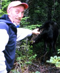 The
author and a calf moose. Photo by P. Gard.
The
author and a calf moose. Photo by P. Gard.
Hikers passing stands of pin cherry and damson plum trees on the East Coast Trail will most likely observe cylindrical or spindle-shaped knots on the twigs and limbs of trees infected by black knot disease.
Black knot disease is caused by a fungus whose scientific name is Dibotryon morbosum or, synonymously, Apiosporina morbosa. The fungus overwinters in knots on twigs and branches and releases infectious spores during wet weather in the spring. The spores germinate and typically infect new growth first, causing the formation of tumor-like growths or knots varying from 1-30 cm or more in length and up to 5 cm in diameter. In late spring, young knots are soft, pulpy, and covered with the velvety, olive-green growth of the fungus. As the summer progresses, the knots turn darker, elongate, and become hard, brittle, rough and black. The knots elongate several inches each year, eventually girdling and killing affected limbs and, possibly, the entire tree.
Commercial fruit growers undertake pruning of infected parts and applications
of fungicide to control black knot disease. In the wild, nature takes its
course and entire stands could be weakened, killed, and replaced by non-susceptible
species.
BACK TO TABLE OF CONTENTS
There are lots of berries on the East Coast Trail. Berry seeds have been carried and dispersed throughout the Trail by berry-eating birds and mammals as well as by wind and water. Because of their comparatively rapid growth, berry plants tend to be early colonizers of forested areas that have burned or been cut for timber or gardens. Berries are available in every season, but there are more kinds to be picked in the summer and fall. East Coast Trail berries provide extensive health and economic benefits to people along the Trail and provide a major food source to a variety of wildlife. Some hikers use the Trail just to get to the berries!
Blueberries
In the province of Newfoundland, blueberry refers to the low sweet blueberry (Vaccinium angustifolium) and the northern dwarf blueberry (Vaccinium boreale). Of the two, the low sweet blueberry is the most common and the most sought after for home consumption. The low sweet blueberry is the most economically important berry in the province. It is also called the lowbush wild blueberry, ground hurts, hurts, and low-bush hurts.
The low sweet blueberry grows on barrens, forest clearings, bogs, and the edges of East Coast Trail paths. It is a many-branched shrub up to 25 cm high with bright green, fine-toothed, pointed, elliptical or lance-shaped leaves about 1 to 4 cm long. The leaves are alternate on the branches, hairless on top and sometimes hairy on the underside. In the fall, the leaves turn a distinctive crimson or scarlet and blueberry patches can be seen from great distances as they contrast with the green hillsides of the Trail. The perfect flowers, in bloom from May to July, are white or pinkish-white, bell-shaped, and about 5 to 10 mm long. Most berries are ripe by late August and are dark blue to black, 5 to 15 mm in diameter, and sweet in taste.
The northern dwarf blueberry grows in exposed areas. It is similar in appearance to the low sweet blueberry but has a higher degree of branching, smaller (3 to 4 mm) white or greenish flowers, and smaller (3 to 5 mm in diameter) berries. It blooms and ripens before the low sweet blueberry.
Blueberries from commercial blueberry farms about the province and independent pickers typically yield in excess of one million kg each year and have sold for about $1/kg to the U.S.A., Europe, Japan, and throughout Canada. Wild blueberries obtain higher prices because they are organically grown and promote good health, including lessening the impacts of aging.
Partridgeberries
The partridgeberry (Vaccinium vitis-idaea) is also known as foxberry, crowberry, redberry, wolfberry, and mountain cranberry. After blueberry, partridgeberry is the second-most economically important berry in the province.
Partridgeberries can be found in a variety of dry environments from
barren hills and cliffs to sheltered forest floors. The plant is a low,
trailing, mat-forming, evergreen shrub about 20-25 mm high with erect,
graceful, slender branches which produce the leaves, flowers and fruit.
The leaves are alternate, crowded, about 1 cm long, thick, leathery, and
a shiny, dark green on top. Their undersides are paler and dotted with
tiny black spots. Flowers are pink, reddish, or white downward- facing
bells in terminal clusters of 2-25 which bloom from June to July. The berries
ripen in September and are a dark, shiny red with a diameter of about 6-8
mm. They are hard and sour before the frost softens and sweetens them and
they may remain on the plant until the following spring.
Yields of commercially picked partridgeberries in Newfoundland
are highly variable, largely due to variations in weather. Damp, calm periods
during flowering can reduce fruit production since pollination is mostly
by wind, rather than insects. Yields average about 66,000 kg each year
with most being exported to Europe and North America. Large quantities
of partridgeberries are picked for home use each year and used to make
a wide variety of foodstuffs, including jellies, sauces, and jams. Special
recipes include mixtures of partridgeberries with blueberries or apple.
Cranberries and Marshberries
The cranberry (Vaccinium macrocarpon) is also known as the large cranberry, the American cranberry, the bearberry, the rockberry, and the bank-berry. On the East Coast Trail, cranberries are most common on the ocean-sprayed headlands. The marshberry (Vaccinium oxycoccus), also called the small cranberry, is a similar plant having smaller berries and most commonly found in the bogs, marshes, and other wet, inland areas of the Trail.
Both the cranberry and the marshberry are low, trailing evergreen shrubs
with small (3-10 mm), alternate, leathery, shiny, dark green leaves which
are whitish or pale green on the undersurface.
The flowers, which usually occur in small clusters, are pink, about
5-7 mm long, and have four long petals that open wide and curve backwards
at flowering time from June to August. Cranberry flower clusters have leafy
shoots extending beyond them. Marshberry flowers occur at the ends of the
branches. The fruits are pale and speckled at first and darken as they
ripen. Cranberry fruits are 1.0- 1.5 cm in diameter, round, and become
dark red to purple when they are ripe in October or November. Marshberry
fruits are 0.5-1.0 cm in diameter, variable in shape from round to elliptical,
and turn red when they ripen in the fall.
Cranberries and marshberries are tart, but sweeten after a frost. Both improve in flavor after they have lain under snow or overwintered. Both are excellent sources of vitamin C and make superior jams, jellies, and sauces.
Bakeapples
The bakeapple (Rubus chamaemorus) is a highly sought after berry of the bogs and barrens. It has a distinctive baked-apple flavour and is rich in vitamin C. The bakeapple is found throughout the northern parts of the Northern Hemisphere and is also known as the cloudberry and the baked-apple berry. Hikers will readily identify the distinctive yellow-orange of bakeapple berries on bogs and barrens and, when travelling to Trail locations, will see berry pickers with buckets and jars selling bakeapples on the sides of the roads.
The bakeapple is a herbaceous plant with a creeping stem and erect shoots
about 10-30 cm high.
The five-lobed leaves are dark green, leathery, toothed along the edges,
and near circular in appearance. Each shoot has one white, usually 5 petaled,
2-3 cm wide flower on a long stalk. The berries are about 1-2 cm in diameter,
hard, red, nearly round groupings of small seeded fruits which soften and
ripen to a yellow-orange from late July to August.
Bakeapple production can be highly variable from year to year, depending on the population sizes of pollinating insects, the distances between male and female plants, frost damages to male flowers in early May, and summer moisture conditions. Bakeapples are eaten fresh, made into preserves, and used to produce liqueurs and wines.
Raspberries
Raspberry (Rubus idaeus) stems or canes are rapid growing, adapted to wet and dry soils, and the berries are a popular food for birds and mammals. As a result, raspberries are one of the first users of areas opened to plant colonization and are found by hikers throughout the East Coast Trail.
Raspberry canes are upright, arching branches covered with bristles and, as they get older, with prickles. Canes are about 0.5-1.5 m high, greenish-red at first, and later change to brown. The 2-10 cm long leaves are dark green above, lighter on the underside, hairless above, hairy below, toothed, and grow on side branches from the canes. The white to greenish-white flowers have 5 petals, are about 1.5 cm across, and grow in clusters near the points of attachment of the higher leaves. In late July and early August, each ripe berry is a red, 1-2 cm diameter, nearly round grouping of small seeded fruits which fall off the cane if left unpicked.
On the Trail, raspberries are commonly eaten fresh by passing hikers. Serious berry pickers also cook them for use in a variety of jams, jellies, cakes, cookies, pies, tarts, and a myriad of other foodstuffs.
Strawberries
Many species and varieties of strawberry (Fragaria) are liable to be encountered along the East Coast Trail. These include wild strawberries, escaped domesticated strawberries, and crossbreeds. All are members of the rose (Rosaceae) family and belong to the genus Fragaria. Many people consider them to be the best of the berries.
Strawberries are very adaptable and may be found in many habitats, including open woods, fields, fens, and grassy headlands. The plants are perennial, about 3-20 cm high, with green, toothed, near round to elongate pointed leaves borne in loose rosettes around the mother plant. Each leaf is divided into three leaflets at the end of its stalk. Most kinds tend to be clustered in colonies as a result of the mother plants' production of runners or stolons which take root and produce daughters out from the main plant. The 5 petalled, white flowers produce red, ovoid to heart-shaped, extremely flavorful berries, usually in July or August. The tiny, edible seeds are visible on the outside of the fruit, embedded in pits or on the surface. Wild strawberries fruits are usually about 1 cm in diameter, while escaped domestic varieties tend to produce larger fruit.
Strawberries have been cultivated since ancient times as a desert and health food. In Newfoundland, domestic strawberries are grown in home gardens and on commercial farms. The fruits are used in a variety of recipes or eaten fresh. The best-tasting strawberries are the wild varieties such as those found along the East Coast Trail.
Blackberries
Blackberries (Rubus) of the East Coast Trail are shrubs of a number of species and their hybrids. Blackberries, also called brambles, are early colonizers of disturbed areas and grow in wet and dry soils.
Blackberries have erect, arching, or trailing stems which are angular in cross section, about 0.6-1.0 m high, and usually are covered with more stout prickles than raspberries. The overall appearance of a blackberry patch is one of a tangled, thorny bush. Leaves grow alternately on side branches from the main cane. Each leaf is compound, comprised of 3-7 toothed, usually pointed, leaflets. Both leaf surfaces are hairless or have hair only on the underside veins. The white flowers bloom in July, have their petals spread wide, and are about 2-4 cm across. The 1-2 cm diameter fruits are at full ripeness in September after turning from green through red to purplish black. Unlike raspberries, they do not fall off the plant if left unpicked. Peak flavor is reached when they lose their gloss and turn slightly dull.
Blackberries are eaten fresh and made into jams, jellies, pies, puddings,
cakes, and wines. As with other East Coast Trail berries, blackberries
are best harvested when the berries are the juiciest, after the dew has
dried in the morning.
BACK TO TABLE OF CONTENTS
Gunning points jut out into the North Atlantic Ocean throughout the length of the East Coast Trail. From early settlement to the present, these points have been used by bird hunters as places of capture for a variety of seabirds.
Hiding places, or gazes, are constructed out of rocks, ice chunks, or tree branches on the gunning points within shooting range of passing birds. Often, carved and painted bird forms called decoys or tollers are placed in the water or on the shore. Birds drawn to the decoys and shot frequently serve as further enticement to additional birds. Birds are subsequently retrieved with gunning punts, floating jiggers, or water dogs. Gunning punts are one or two person rowing boats small enough to easily haul ashore to safety after the hunt. Floating jiggers are carved, aerodynamic, wooden pieces festooned with fish hooks and fastened to fishing lines. These retrievers are also called wooden dogs, Ferryland dogs, and todgers. A jigger is twirled around the hunter's shoulder with the line and cast out to snag the floating dead birds. Water dogs are purebred or mixed breed, but are usually web-footed dogs of Labrador retriever, Newfoundland, or Chesapeake Bay retriever ancestry.
Historically, most types of seabirds were used for a necessary supply of fresh meat, bait, and down fill for bedding and clothing. Large quantities of murres, puffins, gulls, dovekies, and sea ducks were captured whenever they were available and salted, iced, or eaten fresh.
Hunting practices began to change after Confederation in 1949 when The
Migratory Birds Convention Act became applicable. The Act restricted seasons,
methods of hunting, harvest limits, and the kinds of seabirds available
to hunters. Additionally, with economic development, a greater variety
of foods and lifestyles became available to people living along the Trail.
As a result, many of the paths to gunning points became increasingly unused.
At the present time, sea ducks and murres are hunted only during the fall
and winter months and many of the gunning points are used principally as
berry picking locations and viewpoints.
BACK TO TABLE OF CONTENTS
For centuries, people living on and about the East Coast Trail have depended on the sea for their livelihood and transportation. As a result, they have developed a tremendous expertise in the building and use of boats. Hikers on the Trail will encounter a grand variety of boats in storage, tied to wharves, moored at anchor, and underway.
Some of the larger vessels viewed from the Trail include offshore oil drilling ships, supertugs and supertankers for the servicing of the offshore oil industry, recreational cruise ships from anywhere in the world, automobile and passenger ferries, Canadian Coast Guard search and rescue boats, federal fisheries patrol vessels, factory-freezer fishing boats, deep-sea fishing trawlers and draggers, freight container ships, and the occasional armed forces warship. Hikers regularly see such boats harbored in St. John's or, from the high ground of the Trail, observe them travelling to near and very distant locations.
Much more abundant, and present in virtually every community, are the boats used in the inshore or nearshore fishery. While they are occasionally imported, they are mostly constructed individually and uniquely in building sheds as private enterprises or by local boat building businesses offering regularly produced models of proven quality. They are constructed with wood, fibreglass-reinforced wood, fibreglass-reinforced plastic, aluminum or, occasionally, steel.
The most common inshore fishery boats are gasoline or diesel-engine powered, round-bottomed, keeled vessels known as speedboats, skiffs, and longliners. Speedboats are outboard-engine-driven, open boats with planing hulls of about 5-7 metres in length. Speedboats are mostly used for fishing close to shore with small quantities of equipment. Skiffs are inboard-motor-driven, partially decked- over boats of about 8-10 metres in length with narrowed sterns and displacement hulls. Skiffs are used further from shore where rougher water might have to be endured for longer periods of time or when larger load capacities are required. Longliners are inboard-motor-powered, fully decked vessels with displacement hulls, nearly square sterns, and lengths usually from 10-20 metres. Longliners provide sleeping accommodations, increased protection from the elements, and larger load capacities for longer trips at sea. Many of the largest longliners are used in the offshore fishery more than 300 km from land.
Less abundant fishing boats are flat-bottomed, flare-sided, double-ended boats called dories and round-bottomed, narrow-sterned, keeled boats known as punts or rodneys. Both dories and punts are usually less than 5 metres long and may be used with outboard motors, but both are designed to be efficient rowboats. They are often used as lifeboats or tenders for larger vessels.
Most fishing boats are sometimes used for leisure activities such as bird watching and sight seeing, but new types of vessels, designed principally for recreation and tourism, are becoming increasingly abundant along the East Coast Trail. Trail users have seen and experienced sail boats and boards, sea kayaks, motor and oar-powered craft attempting trans-Atlantic speed records, historic Viking and European replica ships, and numerous tour boats, including restored heritage craft.
Experienced hikers on the East Coast Trail are prepared to encounter considerable variation in the flows of the many small rivers and streams that run to the ocean throughout the Trail. In many areas of the Trail, complicated drainage patterns result in slow water run-offs and the production of wet bog, fen, and marsh. However, heavy rainfalls over short periods of time can saturate the ground, overflow rivers and streams, and result in the flash flooding of low lying areas. Such events are not uncommon. The East Coast Trail holds the Newfoundland record for the maximum amount of rainfall in a 24-hour period (15.72 cm at Cape Race).
On the Trail, stream flows tend to be highest in the spring after ice-out and snow melt. Flows then decline over summer to rise again with fall rains. Generally, flows tend to be greater when temperatures are low and precipitation is high. However, dry periods can be expected to result in a lag between rainfall and runoff as the dry ground absorbs water. Saturated watersheds produce faster transfers of rainfall to stream flow.
Stream flow is an important controller of aquatic fauna. During low
water levels, fish movements tend to be minimal and the community structures
of aquatic invertebrates are altered. High water flows are associated with
increased fish movements and the downstream displacement of other aquatic
organisms. As a result, during periods of high stream flow, hikers will
be more likely to observe salmon and trout leaping small waterfalls as
they use the high water level as an aid to their upstream migration. After
periods of high stream flow, concentrations of resting salmon and trout
may be seen in estuaries and quiet pools.
BACK TO TABLE OF CONTENTS
Hikers on the East Coast Trail will experience substantial differences in the climate, flora, fauna, and overall general appearance between the north and south-facing slopes of the Trail. The harbours or bays of the East Coast Trail and their headlands tend to run in westerly to easterly directions. As a result, the hillsides on the northern and southern sides of the bays experience considerably different amounts of exposure to the sun.
The sun's daily arc across the southern sky tends to warm and dry the south-facing slopes while leaving many parts of the north-facing slopes in shadow. Plants receiving more light generally tend to be healthier and stronger while those that receive too little light become weak and spindly, slow maturing, and susceptible to pests and diseases. Wet slope soils don't resist erosion or support new plant growth as well as dry slope soils.
Moisture-loving mosses tend to be more abundant in the shadier, wetter forests of the north-facing slopes just as they are on the shadier, wetter north sides of tree trunks. Tree blowdown from strong winds is most common where soils are wet. Many food berries will be more plentiful in dry, sunny, south-facing slopes than on the damp, shady north-facing slopes.
Variations in slope climate may occur as a result of a great number
of factors other than sunlight, individually and in combination. These
factors include wind direction and velocity, amount of slope, location
on a slope, the presence of gullies, streams and ponds, types of vegetation,
shape of rock formations, soil depth, and soil type. However, hikers travelling
from the shaded north side of a headland to the sunny south side will appreciate
that the orientation of slopes to the sunlight is a major, obvious modifier
of climate and vegetation on the East Coast Trail.
BACK TO TABLE OF CONTENTS
Apart from the stimulatory effects of the droppings of numerous moose and seabirds, the East Coast Trail receives an extensive fertilization by ocean salts and atmospheric nitrogen.
Typical ocean water has about 35 grams of dissolved solids per litre. Overall, the world's oceans are thought to contain as much as 50 quadrillion tons of dissolved solids. The principal dissolved solids are salts of sodium (sodium chloride or common salt), calcium (calcium carbonate or lime, and calcium sulfate), potassium (potassium sulfate), and magnesium (magnesium chloride, magnesium sulfate, and magnesium bromide). These valuable plant nutrients are carried onto the East Coast Trail by bursting bubbles and wind. Interactions between wind and waves, especially at the surf zone, produce a foam of air bubbles separated by nutrient-rich liquid. When the bubbles rise to the ocean surface and burst, they release salt spray into the wind and onto the Trail.
Nitrogen is a plant nutrient particularly important in the control of coastal ecosystems. It is normally present in limiting quantities but, in many coastal areas, human sources of nitrogen equal or exceed natural supplies. This new nitrogen comes from the burning of fossil fuels for power generation and agricultural practices such as the use of fertilizers. Sources of nitrogen on the East Coast Trail may be thousands of kilometres away. From 10-45% of the nitrogen reaching coastal ecosystems is transported and deposited via the atmosphere as wet precipitation or dry dust.
Increased fertilization may not be beneficial to the East Coast Trail.
In other areas, increased supplies of nitrogen have resulted in ecological
impacts with significant economic, political, social, and cultural consequences.
These impacts have included massive die-offs of estuarine and marine plants
and animals, loss of biological diversity, growth of potentially
toxic nuisance algae, loss of habitats important for healthy ecosystems,
and negative effects on desired fisheries.
Hikers travelling through communities on the East Coast Trail will see numerous practice driving nets and backyard pitch and putt courses. As elsewhere, golf is one of the fastest-growing sports in Newfoundland. The province's first course, Bally Haley, was opened in 1896 in St. John's. Local golfers now enjoy seven fully developed golf courses within one-half hour drive of the Trail.
In St. John's and Mount Pearl are four 18 hole, par 5 courses. These are Bally Haley (members or guests only), Admiral's Green, Clovelly Trails Championship, and The Woods. For golfers with lesser amounts of time in the capital city, there are the short, 18 hole, par 4 Clovelly Trails Executive course and the 9 hole, par 5 Captain's Hill course. Additionally, at Holyrood on the Witless Bay Line, is the long, 9 hole, par 5 Willows course with narrow, forest-lined fairways and exceptional water hazards.
Elsewhere across the island, eleven other courses await golfers wishing
to take a break from motoring to the East Coast Trail.
BACK TO TABLE OF CONTENTS
Peat bogs, called moors in Europe, are a dominant feature of the East Coast Trail landscape. As elsewhere in the world, bogs are characterized by a scarcity of nutrients, high acidity, and strong color from decomposing organic materials. The development of a bog requires a good water supply, high humidity, and a plant production exceeding decomposition (a buildup of plant material). Bogs may form where underground springs emerge (spring bogs), on damp slopes (hanging bogs) or most commonly, over accumulations of water in valleys or lowlands.
A lowland bog can often be considered as the end of a process of succession from lake (or pond) to fen to bog or, simply, the final stage in the aging of a pond. With the progressive filling of a pond basin by sediments and the growth of new plants, a fen forms. Typically, fens receive a large portion of their nutrients from sources other than rainwater while, as the bog develops and rises, its principal water source becomes rainwater. With increasing acidity from plant decomposition, peat mosses such as Sphagnum colonize the developing bog and further increase acidity. Nutrient levels are reduced and the plant and animal communities become less diverse. As the Sphagnum mosses become crowded, they grow vertically upwards, die at the base, and gradually form characteristic hillocks or complexes of hummock-hollows on the bog.
The hummocks, being drier than the hollows, support Sphagnum mosses different from the more moisture adapted ones of the lower hollows. Sphagnum mosses, with their ability to absorb up to twenty times their own weight of water, draw the water-table of the bog system upwards as they grow.
Bogs are acidic, low in oxygen, and high in organic substances. These conditions enable bog waters to dissolve high amounts of iron and form organic iron compounds. When in contact with air, these iron compounds precipitate as iron ochre which hardens into a metal called bog iron. Bog iron ore takes approximately 20 years to form through the chemical process in the streams. Bog iron was used by Newfoundland Vikings who heated it to remove impurities and then pounded it into shapes to make tools and weapons.
Bog ochre occurs as yellow and red ochre which grades into sienna
(yellow- brown), umber (a darker brown), burnt sienna ( brown or bright
red) and burnt umber (a darker brown than umber).
Red ochre mixed with fish oil or animal fat was commonly used as a
body paint by the Beothuk Indians of Newfoundland. The practice was so
excessive that even the Micmac referred to them as the Red Indians, and
it is believed the term "redskin" used for Native Americans probably originated
from early contacts between European fishermen and the Beothuk. Red ochre
mixed with fish or seal oils was at one time an inexpensive and common
paint throughout Newfoundland fishing communities.
A myriad of aquatic insects live on and about bog waters. Predatory dragonflies and damselflies (Odonata) can be easily observed in their immature stages (nymphs) hunting other insects on plants and the water bottom. Rudimentary wings can be seen on the grey to greenish nymphal forms. Adults of both dragonflies and damselflies hunt other flying insects and deposit their eggs on the water surface. Both have two pair of net-veined wings but dragonflies are larger than damselflies and are much stronger fliers. Black shiny whirligig beetles (Gyrinidae) circle at the surface looking above and below the water with their two sets of compound eyes as they scavenge and hunt other insects. Long-legged water striders (Gerridae) skate on the surface film in search of any insects to eat.
Bog insects may in turn be eaten by Newfoundland's carnivorous plants-
all bog inhabitants.
Pitcher plants (Sarracenia purpurea), perhaps Newfoundland's most famous
sphagnum bog plant, have flared tubular leaves lined with downward pointing
bristles that trap insects venturing in. Yellow aquatic bladderworts (Utricularia)
possess bladders that open and suck in small insects when activated by
touch. White-flowered, round-leaved sundew (Drosera) have a rosette of
sticky, haired leaves that attract, enfold, and digest insects.
BACK TO TABLE OF CONTENTS
Recorded distances between places on the East Coast Trail have been
determined by Trail workers pushing a measuring wheel in front of them
as they hike the Trail.
The measuring wheel is a Measure Master Model MM-30M made by Rolatape
Corporation in Spokane Washington, U.S.A. It is a steel, three-spoked,
rubber-tired wheel mounted on a single, jointed and foldable (for carrying)
handle. Attached to the axle of the wheel is an 80 mm x 60 mm x 45 mm box
containing a 4-digit odometer and a readable screen similar to the odometer
on a car. The circumference of the wheel is exactly 1 metre and the odometer
records each revolution to one tenth of a metre or 10 cm. The wheel, handle,
and odometer weigh about 3.2 kg.
Accurate wheeling of the Trail requires that the wheel maintains contact
with the Trail at all times so that it cannot spin freely. Accordingly,
it is wheeled up and over rock and wood steps and through the waters of
brooks too small to be bridged. Small amounts of operator variation in
measurement occur as a result of left and right-handed workers wheeling
different sides of the winding Trail. Such variation amounts to only a
few steps in a one-hour hike or the difference in the distances covered
by the equal numbers of steps of short and long-legged hikers.
BACK TO TABLE OF CONTENTS
When winter food supplies become scarce in their Arctic habitat, many snowy owls (Nyctea scandiaca) migrate south. Winter hikers often observe these large, white birds on the high, barren grounds of the East Coast Trail and, in the spring and summer, see their pellets of regurgitated waste scattered about the paths.
Snowy owls are the heaviest North American owls, with heights up to
70 cm and wingspans up to 150 cm. In the summer, they live on the Arctic
tundra and are coloured brownish with darker spots and stripes. In the
winter, when they visit the East Coast Trail, male adults are almost completely
white. Females and younger birds retain some of their brown or black markings.
Snowy owls have prominent yellow eyes and black beaks, very round heads
with no ear tufts, and large feet covered with feathers for warmth. They
are most active early and late in the day, and have long, midday rest periods.
They prefer open, treeless spaces but, in the winter, may be seen hunting
nearly anywhere.
In the Arctic, snowy owls eat a wide variety of birds and mammals,
but feed principally on lemmings. Lemmings are species of small, brown
rodents which undergo extreme population fluctuations with an approximate
four year boom and bust cycle. When lemming populations crash, the largest
snowy owls tend to defend the prime food territories and drive less socially
dominant birds out, forcing them to move farther south.
Snowy owls swallow their prey whole or in chunks. Non-digestible hair,
bones, teeth, claws, and feathers are spit out or regurgitated as longish
(about 3-6 cm) grey pellets. Hikers on the East Coast Trail may determine
the prey of local snowy owls by gently breaking open the pellets and examining
their contents.
BACK TO TABLE OF CONTENTS
Hikers on the East Coast Trail have the opportunity to view exceptionally large ocean fishes. When the sea is calm, ocean sunfish, basking sharks, and bluefin tuna can be seen from the high ground of the Trail.
Ocean sunfish (Mola mola)
The ocean sunfish is a short, deep, laterally-compressed, nearly oval-shaped fish with a small, terminal, beak-like mouth and large, triangular dorsal and ventral (anal) fins. Its tail is only a small leathery fold so that the overall appearance is that of a tailless fish head higher than it is long. Its other common names are headfish, moonfish, and millstone. This unusually shaped, gray to silvery fish may grow to more than 3 metres long and in excess of 900 kg.
Off the East Coast Trail, ocean sunfish occur only as summer visitors feeding mostly on jellyfish, crustaceans, molluscs, and starfish. They are usually seen resting at the surface, but sometimes jump out of the water by flapping their dorsal and anal fins from side to side for propulsion.
Basking shark (Cetorhinus maximus)
Basking sharks are the second largest fish in the world (after whale sharks) and are regular visitors to the waters off the East Coast Trail. These docile, slow-moving giants reach lengths of more than 10 metres and weights over 3 tonnes. They have a typical shark-like appearance except for the presence of five large, collar-like gill slits extending onto the top and bottom surfaces of the body behind the head. The upper body is gray-brown to nearly black while the underside is lighter.
Basking sharks spend a large part of their time cruising at the surface with their mouths open while they strain plankton from the water. In the area of the East Coast Trail, they are mostly seen in the spring and summer and almost disappear in the fall and winter months.
Bluefin tuna (Thunnus thynnus)
The giant bluefin tuna is a highly migratory species which grows to greater than 3 metres and over 675 kg. It is a stout, exceptionally streamlined, powerful fish coloured dark blue to black on the back. The sides shade to a lighter blue and then to silvery gray below. The fins and smaller finlets on the upper and lower surfaces ahead of the tail are usually tinged yellow.
Giant bluefin tuna visit the waters off the East Coast Trail in early
summer and remain until the fall. They are hunted by both sport and commercial
fishers. Schools of tuna may be observed causing commotions near the surface
of the water as they feed on squid, capelin and a variety of other small
fishes.
Hikers on the East Coast Trail will see numerous stumps and broken branches stained a striking cyan or blue-green colour by mushrooms commonly known as blue-green stain mushrooms, green stain disc mushrooms, green wood cup mushrooms, and blue-stain fungi. The stain is produced by the mycelium or vegetative, thread-like stage of mushrooms of the genus Chlorociboria.
Hikers will observe the stained wood all year round, most often on hardwoods, but will only rarely see the fruiting bodies of the mushroom, most likely after extended wet periods in late summer and fall. The fruiting body or apothecium has a stem rarely more than 3 mm long. Its top, smaller than a centimeter in diameter, is shaped like a spatula, cup, or disc. It is most often coloured blue-green but, depending on the species, may be orange.
Wood stained by the fungus has been used for wood inlays and the green pigment has been used to tint porcelain. The fruiting bodies are inedible.
Communities along the East Coast Trail were well settled by people of Irish descent before Ireland's famines of the 1840s and the resultant mass emigration to the mainland of North America.
Although the Irish were closer to Newfoundland cod than their western European neighbours who had sent fishing fleets as early as 1500, the Irish only started to participate in Newfoundland trade on a small scale in the late 1600s. This relatively late start has been attributed primarily to the English domination of the Irish and the secondary influence of factors such as civil unrest, insufficient private capital, unsuitable shipping, insufficient local markets for salt fish, and the scarcity of skilled tradesmen. Once started, however, the Irish colonization of Newfoundland was swift.
After 1675, English fishing masters began to provision their vessels at less expensive Irish ports on their way to Newfoundland. They also obtained cheap Irish labourers or servants ("youngsters") for work in the fishery. The youngsters typically worked for two summers and a winter in Newfoundland before returning to Ireland. After 1699 and the passage of the Newfoundland Act requiring English ships' masters to employ a percentage of apprentices, the number of Irish involved in the Newfoundland fishery increased substantially.
Following the Britain-France peace Treaty of Utrecht in 1713, the expansion of the English fishery, major crop failures in Ireland between 1726 and 1741, and the availability of cheap transportation to Newfoundland, the Irish outnumbered the English on the southern Avalon Peninsula. St. John's began to form an enduring geographic, ethnic, and cultural midpoint between the predominating concentrations of Irish Catholics to the south and English Protestants to the north.
From 1800 to 1836, the Irish population of Newfoundland increased more than five-fold to make up about half of the island's population. The vast majority of Irish Newfoundlanders came from southeastern Irish counties such as Wexford, Waterford, Kilkenny, Cork, and Tipperary.
Apart from a variety of mini-submarines used for undersea research or expensive deepwater touring, hikers on the East Coast Trail will occasionally observe visiting submarines tied to the wharf or underway to and from St. John's Harbour. These diesel-electric powered, Canadian Armed Forces machines are likely to be one of the three 1960s built, 90 metre, Oberon-class submarines or their four faster, quieter replacements, the 70 metre, Upholder-class, attack submarines built in the 1990s, but declared surplus by Britain's Royal Navy.
These modern, hi-tech warships, capable of identifying ships over a 125,000 square km area while submerged for about 50 days, do not differ greatly in size from the German "U boats" berthed in Bay Bulls Harbour following the close of the second world war. Best known of those was the U-190, launched in Germany in 1942 to disrupt and destroy allied shipping. U-190 was one of a total of 144 type IXC/49 boats. U-190 made six voyages into the Atlantic and, despite a number of attempts, only sank the 7,015 ton cargo ship Empire Lakeland on March 8, 1943 and, on April 16, 1945, the last Canadian vessel to be lost due to enemy action in the second world war, the minesweeper HMCS Esquimault off the entrance to Halifax Harbour. Following the attack on the Esquimault, U-190 patrolled the Canadian coast until ordered to surrender by the German high command on May 8. Her Captain signed a document of unconditional surrender on May 11 after arrest by Canadian warships about 850 km off Cape Race. The U-190 was escorted into Bay Bulls on May 14 and her crew was imprisoned in Halifax.
In June 1945, U-190 was commissioned into the Royal Canadian Navy along with another U-Boat (U-889) that surrendered at Bay Bulls. U-889 was subsequently ceded to the United States and U-190 became an anti-submarine training vessel until she was sunk during a ceremonious target practice over the hulk of her last victim, the HMCS Esquimault.
Hikers traveling the East Coast Trail between the North Head of Motion Bay south to Long Point will pass the Petty Harbour-Maddox Cove Protected Fishing Area. The Protected Fishing Area extends roughly 2.4 km from land and is about 11.2 km long. It was intended as a hand-line only fishing zone created to preserve historic community rights and resolve conflicts among fishers using different types of fishing gear.
A hand-line is a single, hand-held line with an attached sinker and baited hook fished just above the ocean floor. Hand-lining is considered to be one of the most ecologically sound fishing methods for cod because it produces high quality catches while minimizing damage to other species. However, effective hand-line use is prevented by longlines and nets which disperse the fish and tangle the hand-lines.
Traditionally, some fishing areas around Petty Harbour-Maddox Cove had been reserved exclusively for hand-line use and, when cod traps were used, their sizes were restricted so that they would not intrude upon hand-lining grounds. From 1895 to 1960, regulations reserved selected areas around the coast of Newfoundland for hand-line use. However, the federal government repealed those regulations to favour the use of what it considered to be more advanced gear types; gill nets and longlines. In 1961, Petty Harbour fishermen unanimously established The Protected Fishing Area and prohibited the use of longlines there. In 1964, they voted to exclude the use of gill nets in the Area. The federal government followed these votes with the creation of new legislation but, since that time, restrictions have weakened.
Because of their historical use of the Area, Bay Bulls fishers were issued special permits to use longlines at Shoal Bay from 1990 until the 1992 moratorium on northern cod. In 1996, Petty Harbour - Maddox Cove fishers voted to allow the use of gill nets for the capture of lumpfish in The Protected Fishing Area.
Apart from its historically good fishing grounds, the Petty Harbour area of the East Coast Trail has been well known for its inhabitants' active involvement in fisheries-related issues.
A Fishermen's Committee was formed in 1923 to organize and manage the local trap fishery. The Committee continues to participate in community decision making. In 1961, Petty Harbour fishermen unanimously established The Protected Fishing Area of Petty Harbour-Maddox Cove, prohibiting the use of longlines and, three years later, gill nets in the Area. In 1983, the Petty Harbour Fishermen's Cooperative was formed, giving fishers control over the production and marketing of their own fish for the first time.
The Fishermen's Cooperative had grown out of an informal system of allocating daily landings at the local fish distribution or feeder plant to different trap crews. With more cod-trap crews (23) in the community than any other in the province, as many as 90 traps in the water, and landings in excess of 6 million pounds, the fishermen were experiencing recurring problems in selling a glut of cod to plants looking for capelin and squid. Eighty-four of the 95 fishermen in the harbour put in $500 each to become shareholders. A $100,000 salt-fish processing plant was built and quickly changed to a freezing facility employing 150 workers. Cod, capelin, and squid were processed. There were 48 members of the Petty Harbour Fishermen's Cooperative in 2000.
With the dispersion of ticks throughout North America aided by migrating birds, hikers on the East Coast Trail risk a small but increasing chance of exposure to diseases carried by ticks.
Ticks are pinhead to peppercorn sized, rounded, spider-like creatures numbering over 850 different species which parasitize all classes of vertebrate land animals. Ticks transmit almost as many human diseases as mosquitoes. Ticks can cause disease and illness directly and indirectly. They are responsible for anemia due to blood loss, dermatosis due to salivary secretions, and ascending tick paralysis due to neurotoxins in the salivary secretions. They can carry diseases such as babesiosis, anaplasmosis, ehrlichia, east coast fever, relapsing fever, rocky mountain spotted fever and Lyme disease.
Ticks insert their heads under the skin of hosts, gorge themselves on blood, and may, over a few hours or several days, blow up like small balloons. Depending on the species, ticks vary in the length of time their egg- larvae- nymph- adult life cycle takes and the number of hosts involved. Juvenile ticks usually live in the soil or at ground level, especially in old field-forest habitat. They climb up a blade of grass or a leaf, and wait for a passing host to attach themselves to.
When ticks are abundant, experienced hikers wear long pants tucked into light-coloured socks so ticks can be easily spotted and hats to keep off the ticks dropping from trees. Hikers finding an attached tick should use tweezers to slowly and gently pull it off with its imbedded head, apply disinfectant, and check in with a doctor.
From spring to fall, hikers on the ocean shore of the East Coast Trail will observe boats and fishers engaged in fishing activities. Hikers will also see the red-orange balloons used to mark and float the retrieval or mooring lines of stationary fishing gear close to shore and a variety of fishing equipment in storage in and near communities along the Trail. Since the beginnings of settlement, Newfoundlanders have directed most of their fishing efforts towards Atlantic cod (Gadus morhua). They have used a variety of increasingly efficient fishing equipment. Five basic gear types have been commonly used in recent times.
Hand-lines
A hand-line, in its simplest form, is a single, hand-held line with an attached sinker and baited hook usually fished just above the ocean floor. When not in use, hand-lines are wrapped around flat, rectangular, wooden assemblies called "reels". Hand-lining is considered to be one of the most ecologically sound fishing methods for cod because it produces high quality catches while minimizing damage to other species. Hand-lines were used by the earliest fishermen and continue to be used today, most often from smaller boats close to shore.
Over time, variants of the simple hand-line have been developed. Durable, synthetic lines of more than 135 kg breaking strength are favoured by the majority of hand-lining fishers. Hooks are corrosion resistant and readily obtainable in a variety of sizes and styles. Some hooks are imbedded in leaden weights and fished plain or painted and with or without natural or artificial baits attached. The traditional Newfoundland "jigger" was made by fastening two hooks together with the barbs apart and pouring lead around the shanks of the hooks in the form of a fish. Typically, no bait was used with a jigger. Jiggers were jigged up and down to attract fish and snag them in any part of the body. The traditional jigger is now banned because of its damage to fish flesh and its wounding and release of fish. Recently, single or treble-hooked, chrome-plated, Norwegian jiggers of about 0.5 kg have come into use by fishers. Additionally, the use of deep-sea angling equipment for codfish capture is becoming more widespread by non-commercial fishers, fishing from boats and from the shore.
Longlines
Longlines, also called longline trawls or bultows, are single, heavy
lines with many baited hooks attached by short leaders or gangeons. Longlines
are taken aboard as the hooked fish are removed or the lines are left in
the water as the fish are taken off and the hooks are rebaited. First used
in the late 1700's, longlines were coiled in wooden tubs as they were hauled
aboard and the hooks were attached to the sides and edges of the tubs.
In the 1970's a variety of automated longlining systems became more common,
especially on the larger, decked boats known as longliners. Gangeons were
clipped to longlines as they were unspooled from power drum winches or
hooks were dragged from batteries of stainless steel hook racks as the
longlines were "shot" out from the sterns of boats.
Trawls
A trawl is a large net bag dragged through the water by two heavy cables from the stern (stern trawlers) or side (side trawlers) of a large fishing vessel. Such vessels, called draggers, typically fish far from shore for days at a time and engulf everything in the path of the trawl. Otter trawls have two heavy (up to 680 kg) otter doors to sink the trawl and hold the trawl bag open. Mid-water trawls are fished at shallower depths, typically for species other than cod.
Gill nets
A gill net is a sheet of monofilament net about 91 metres long and
1.8 metres high with weighted bottom and floating top lines. Codfish gill
nets are typically set on the bottom and fish attempting to swim through
are caught in the mesh.
Cod traps
The cod trap is considered the most efficient gear ever designed for
cod fishing. The traditional Newfoundland cod trap is a large, stationary,
topless, net box fished on the bottom and held in position, typically close
to shore, with lead weights and anchors on the bottom and floats on the
top. The cod trap has a net "leader", a long extension from the trap towards
shore that blocks the passage of fish and redirects them into a door in
the trap. The Newfoundland cod trap was first fished in 1871. Japanese
cod traps, similar to Newfoundland cod traps but differing principally
in their use of modified doors and a roof on the trap box, have been
fished since the 1970's. Cod traps are fished in well proven, good fishing
locations called berths. Berth use is determined by lotteries held annually
within communities by local fishers.
At various locations throughout insular Newfoundland and at Witless Bay on the East Coast Trail, crab and, to a lesser extent, shrimp shells are collected for the extraction of chitin and its derivatives. Chitin (pronounced KITE-in) is the hard, major component of the outer covering or shell of spiders, insects, lobsters, shrimp, and crabs. It is the second-most (after cellulose) plentiful organic compound on earth but, after processing, may sell for up to $1000 per kilogram.
First discovered in the early 1800's, chitin and its rapidly developing derivatives possess vast and remarkable non-toxic, non-allergenic, biodegradable, antibacterial, anti-fungal and anti-viral properties. These characteristics provide for a variety of improvements to food, nutrition, cosmetics, medical treatment, agriculture and the environment.
After edible meats are removed, shells are washed, dried, packaged and shipped for further processing. Shells are then given alkaline and acid baths to remove impurities. The resulting derivative, called chitosan, may be produced as flakes, powders, beads, fibres, sheets and films.
Chitosan is widely used as a water purification agent as it coagulates and precipitates a variety of contaminants including minerals, metals and oils. It is particularly useful for biomedical applications, such as wound dressings, surgical sutures and as aids in cataract surgery and periodontal disease treatment. Apart from an increasing number of other uses, chitosan is popularly known as a dietary supplement for its weight loss and cholesterol controlling properties.
To stimulate the development of the shellfish shell processing industry, the provincial government has legislated a two-year phase-in (beginning in 2002) of a prohibition against the dumping of shellfish waste.
Cod liver oil has been a product of the Newfoundland cod fishery since the sixteenth century. It has been produced and purified by a variety of improving methods and, by 1857, there were three cod liver oil factories in Petty Harbour. Cod liver oil has been used for leather tanning, lamp and heating fuels, and for a variety of medicinal purposes. Many hikers on the East Coast Trail use cod liver oil as a dietary supplement and a general health tonic.
Cod liver oil contains many nutrients not easily obtained from non-marine sources. It also contains the fat-soluble vitamins, A, D and E as well as high amounts of essential, polyunsaturated, eicosapentanoic and docosahexanoic acids known as omega-3 acids. The health benefits of the omega-3 acids are well documented and extensive. These benefits include a reduced risk of heart disease, an easing of the pain and inflammation of arthritis and rheumatism, a modulation of the immune system, improved night vision, and a general sense of well being.
For many hikers, cod liver oil has an unpleasant taste. However, it continues to be the subject of extensive research and much has been done to make it more palatable, including the packaging of the product in capsules. Recently, the beneficial omega-3 acids have been commercially produced from seal blubber and marketed internationally.